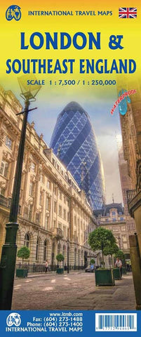
London & England Southeast ITM Map 6e
Description:
Folded street and road map, printed on waterproof paper. One side covers London at scale 1:7,500, The reverse side shows expanded map of Southeast England at scale 1:250,000. The western edge of the map is Bath and the northern extreme is either Northampton or Cambridge. The main roads in and out of London are shown, with motorways in blue, A roads in green and thousands of B roads wend their way to lovely villages and secondary towns. Both sides of the map include our Top Attractions list.
Updated edition 2024
We think you may also like...
-
 $14.95
 -
 $19.95