The Maritime Provinces of Canada, Emanuel Bowen, 1747
Description:
SHIPPING IS NOT INCLUDED - Please contact for a quote.
ORIGINAL ANTIQUE MAP
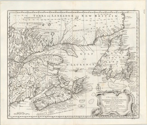
"A New & Accurate Map of the Islands of Newfoundland, Cape Breton, St. John and Anticosta; Together with the Neighbouring Countries of Nova Scotia, Canada &c..."
Mapmaker / Publisher: Emanuel Bowen
Date: circa 1747
Size: 19" x 16"
This attractive map of the Gulf of St. Laurence is based on Bellin's definitive map of 1744. It is very detailed with hundreds of place names, especially along the coastlines. The major fishing banks are well delineated. There is a large decorative title-cartouche and a compass rose at bottom right. This is the first state with "No. 95" at the bottom right.
Certificate of Authenticity is provided.